Currently scouting out for the next Walk for Freedom adventure, in County Durham, from Bishop's Auckland, to Durham itself and onto Finchale Priory on the banks of the river Wear (of Tyne and Wear nomenclature!) See lots of photos on our Flickr Album (Click Here)
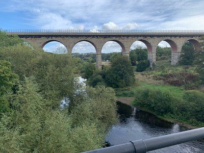 |
| The Road (was Railway) Viaduct into Bishop's Auckland) from the pack horse crossing |
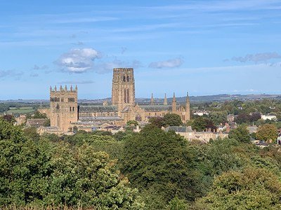 |
| Durham Cathedral "sailing" on a sea of Green - The Cathedral sits on a high rock outcrop and is a steep walk to visit. |
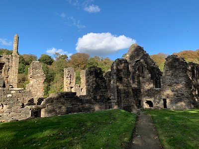 |
| Finchale Priory (or Abbey) started in 1196 on the Banks of the River Wear |
These photos were recorded upon several of the potentails walks over old railway lines and of ancient 'lanes' {Frankland Lane] trod by Monks heading to the Finchale Priory many centuries before us!
Frankland Lane History
The Durham end. The lane starts at Sidegate, by Crook Hall. Sidegate was a manor whose name literally meant a side entrance into the city, so you were leaving Durham by one of its old back ways. The oldest surviving part of Crook Hall was built by Peter del Croke in the first half of the 14th century, probably replacing an earlier building. englandsnortheast global
The bishops' park. The lane takes its name from Frankland, which was a hunting park for the Bishops of Durham, with lands stretching down towards the centre of the city. The Victoria County History notes that paths led across the fields from the road by Crook Hall to Frankland, where the bishops had their park. By the 19th century the park was long gone as a working deer park: the land had been enclosed and divided into farms well before 1840, yet a keeper of Frankland park was still being appointed as a sinecure as late as 1848. The farm called Frankland Park, on the sloping fields above the Wear, preserves the name, and you will have passed through that farmland on the climb. Durham City : Framwellgate and Neville’s Cross - England's North East +3
The Finchale end. The priory grew from the hermitage of St Godric in the 12th century and later became a rest house for the monks of Durham Cathedral priory. It is reasonable to suppose that monks and servants travelling between the two used a route along this side of the river, but I haven't found a source that says the present lane is that route, so treat it as likely rather than proven.
Later layers. The north end is much more recent in character. Brasside Pond is an artificial lake left by clay digging for a neighbouring brickworks, which closed long ago along with its branch railway, and Frankland Prison now sits beside it. durham
So the sunken, hedged feel you noticed fits: it is an old access track through a medieval episcopal park, later a farm lane after enclosure.